


Page 1 of 10
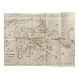
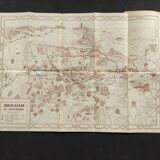
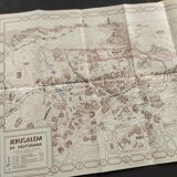
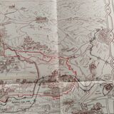
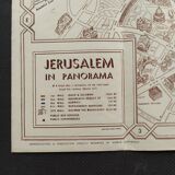
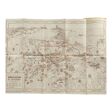
Panoramic map of the city of Jerusalem 1950's
€200
Panoramic map of the city of Jerusalem 1950's
€200
- Dimensions :
- H40 x W56
- Color :
- white
- Material :
- paper
- Style :
- vintage
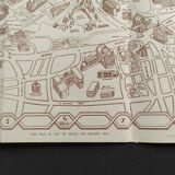
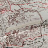
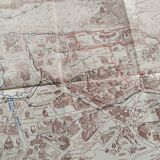
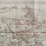
This is an illustrated map of jerusalem made by spyro spiridon (spyridon) in 1953. Spiridon's map shows sights of the city in profile, including schools, hospitals, churches, synagogues, hotels, and even the y.m.c.a. The dome of the rock, the western wall, the church of the dormition and the walls of the old city are clearly visible. The dead sea appears along the upper right edge. 56*40 cm. 1960's.